1827 American Coast Pilot by Blunt MAPS Nautical Guide Navigation Lighthouses Harbors

Originally printed in 1796, Edmund Blunt’s ‘American Coast Pilot’ was one of the earliest American works of navigation and travel. Blunt authored other nautical works which held great esteem and merit, and, according to Allibone,
“this work sustains a high reputation for accuracy, and is in general use by American merchant-marine. It has been translated into most of the languages of Europe.”
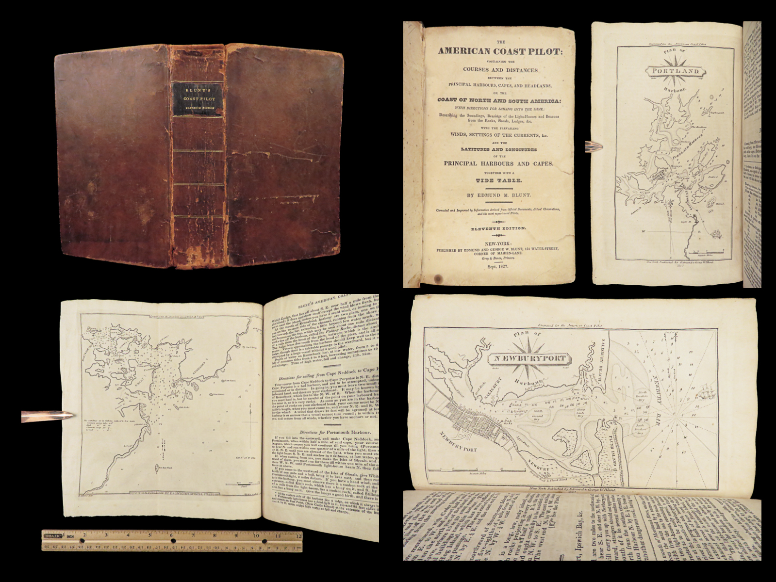
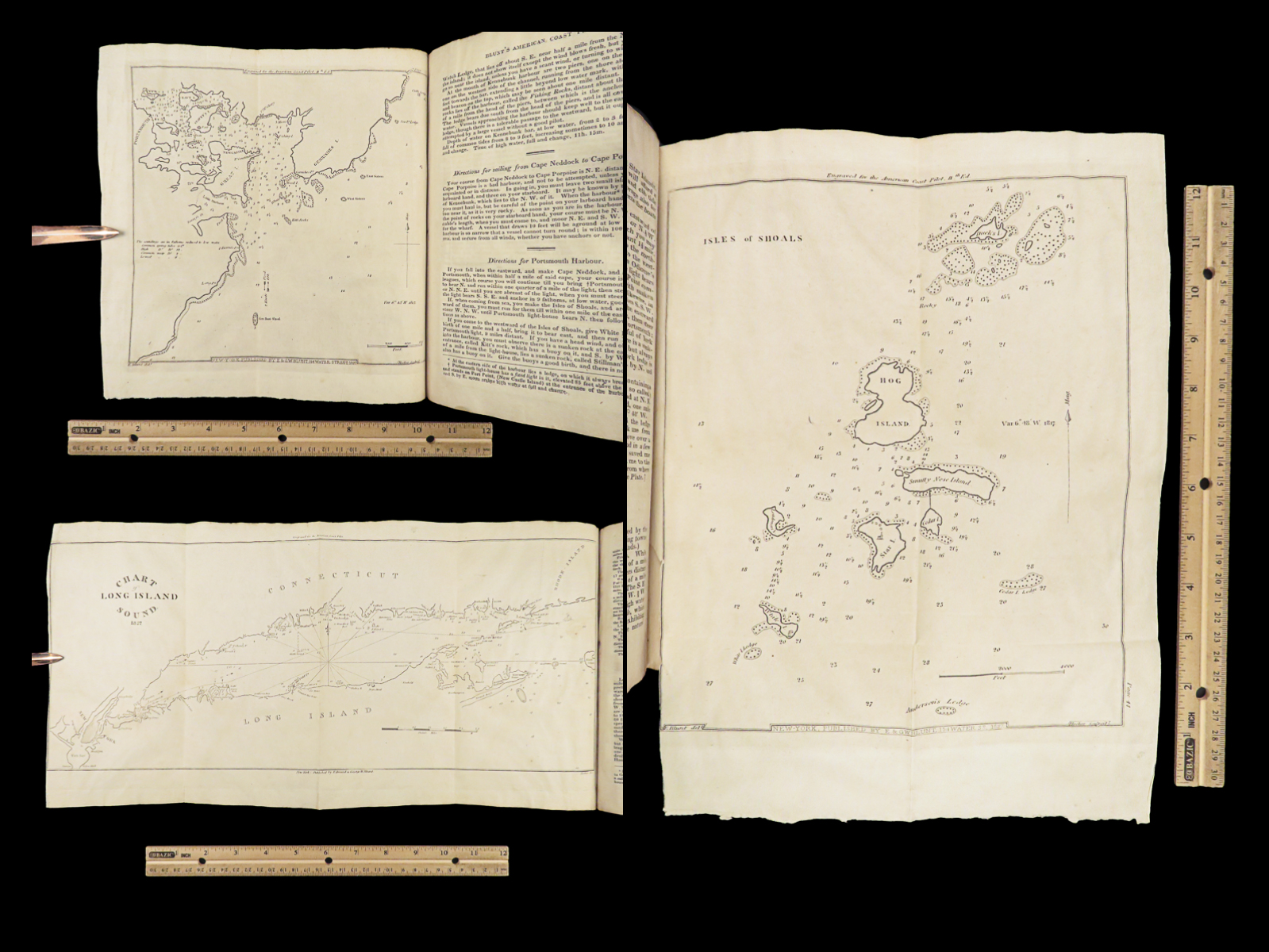
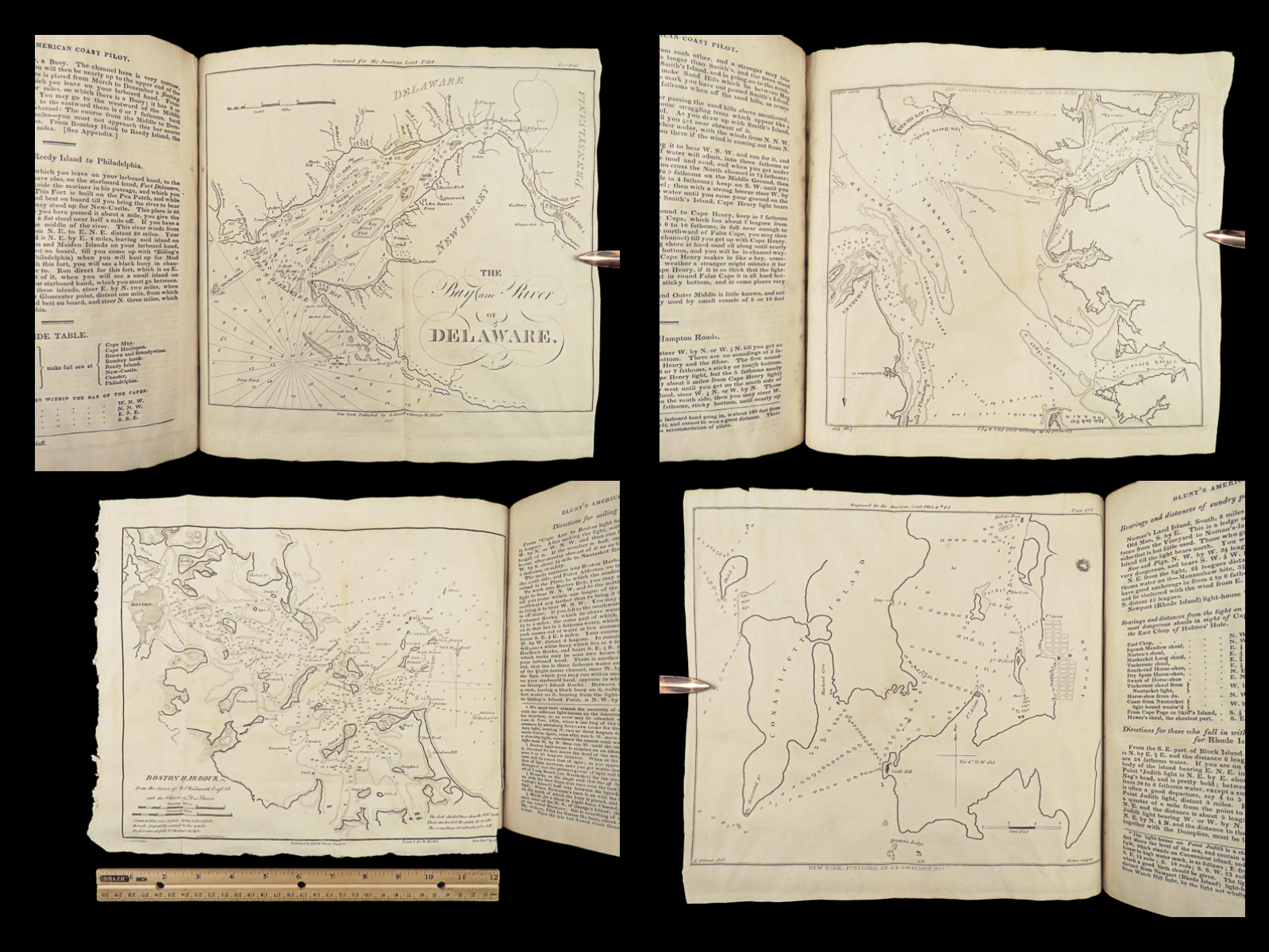
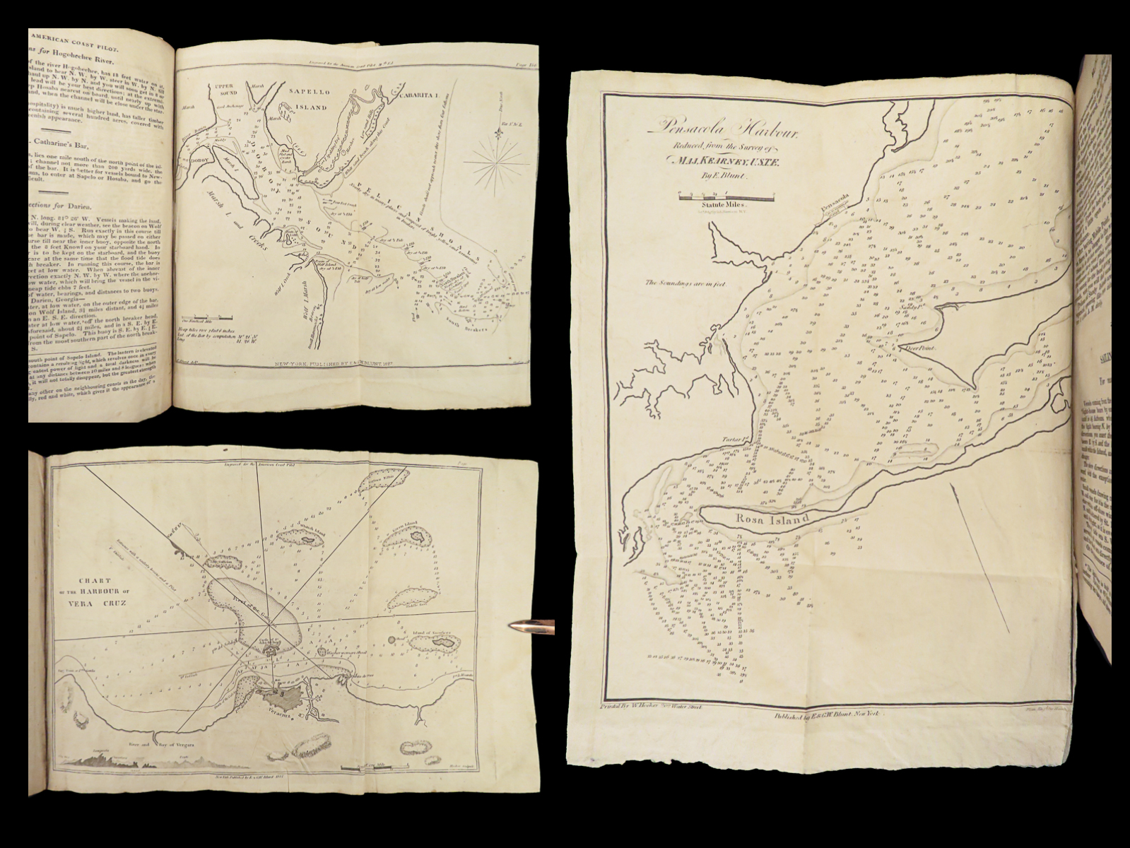
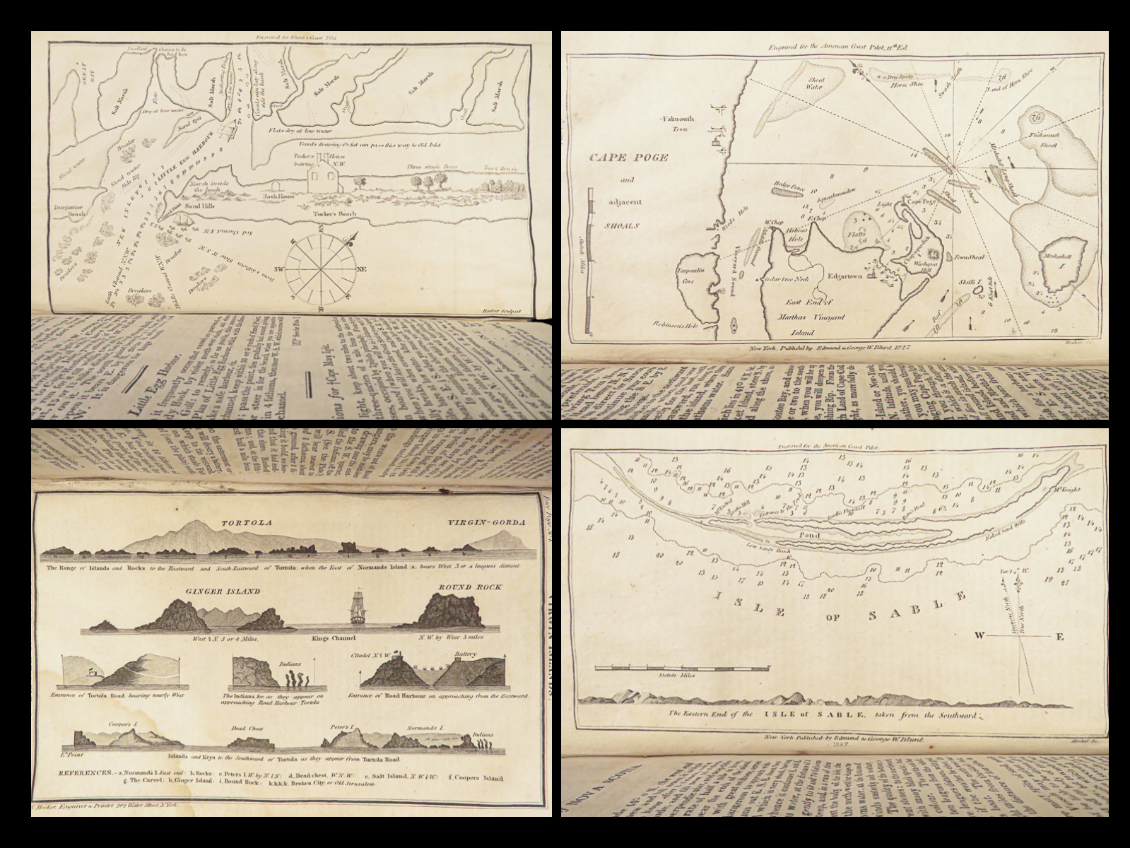
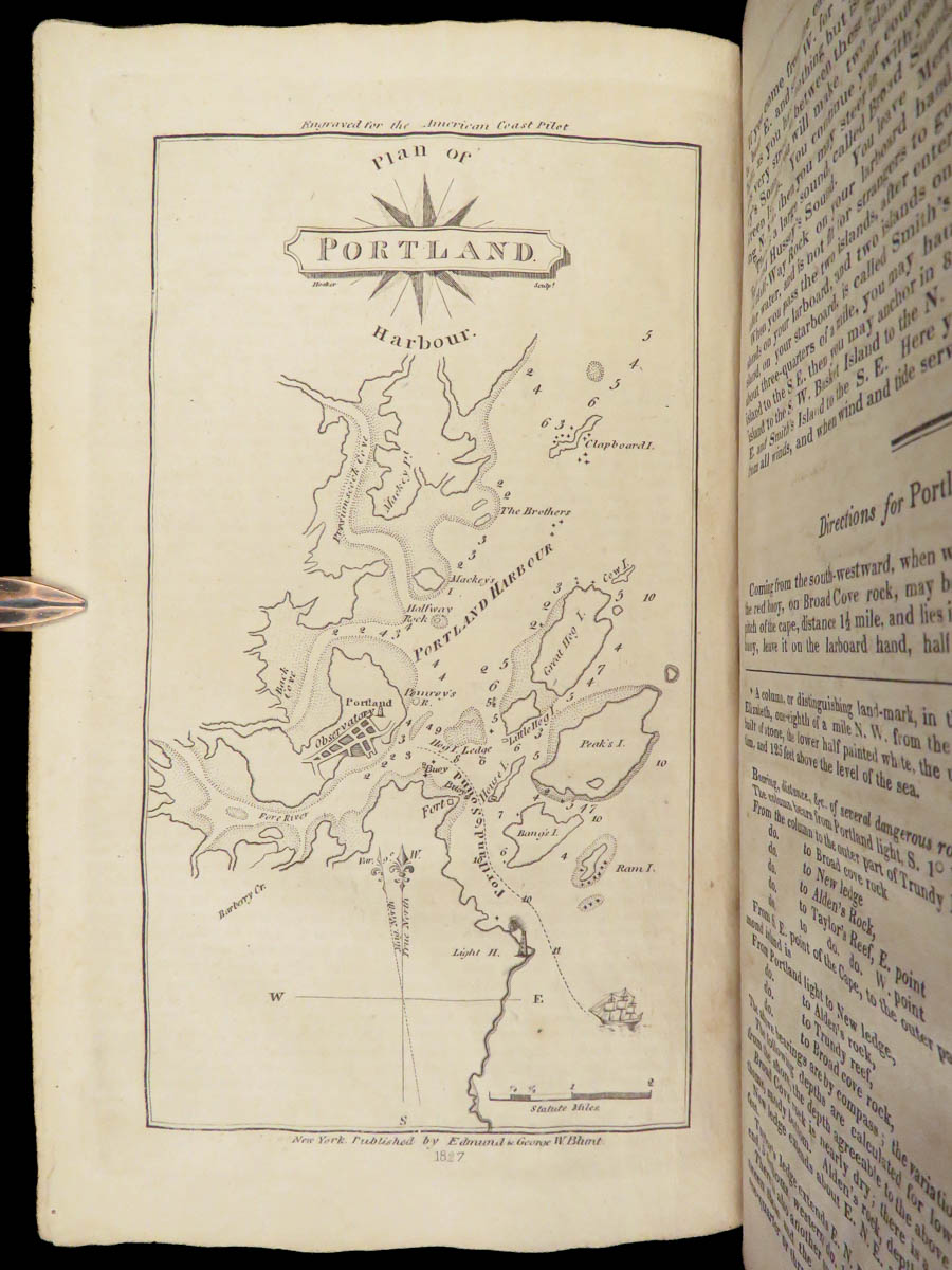
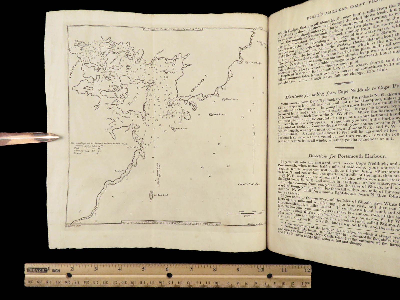
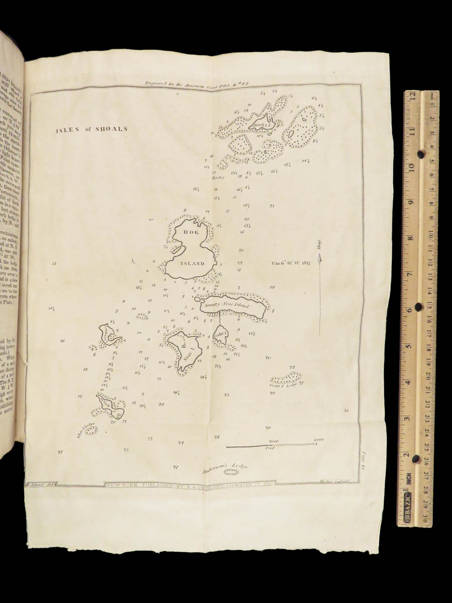
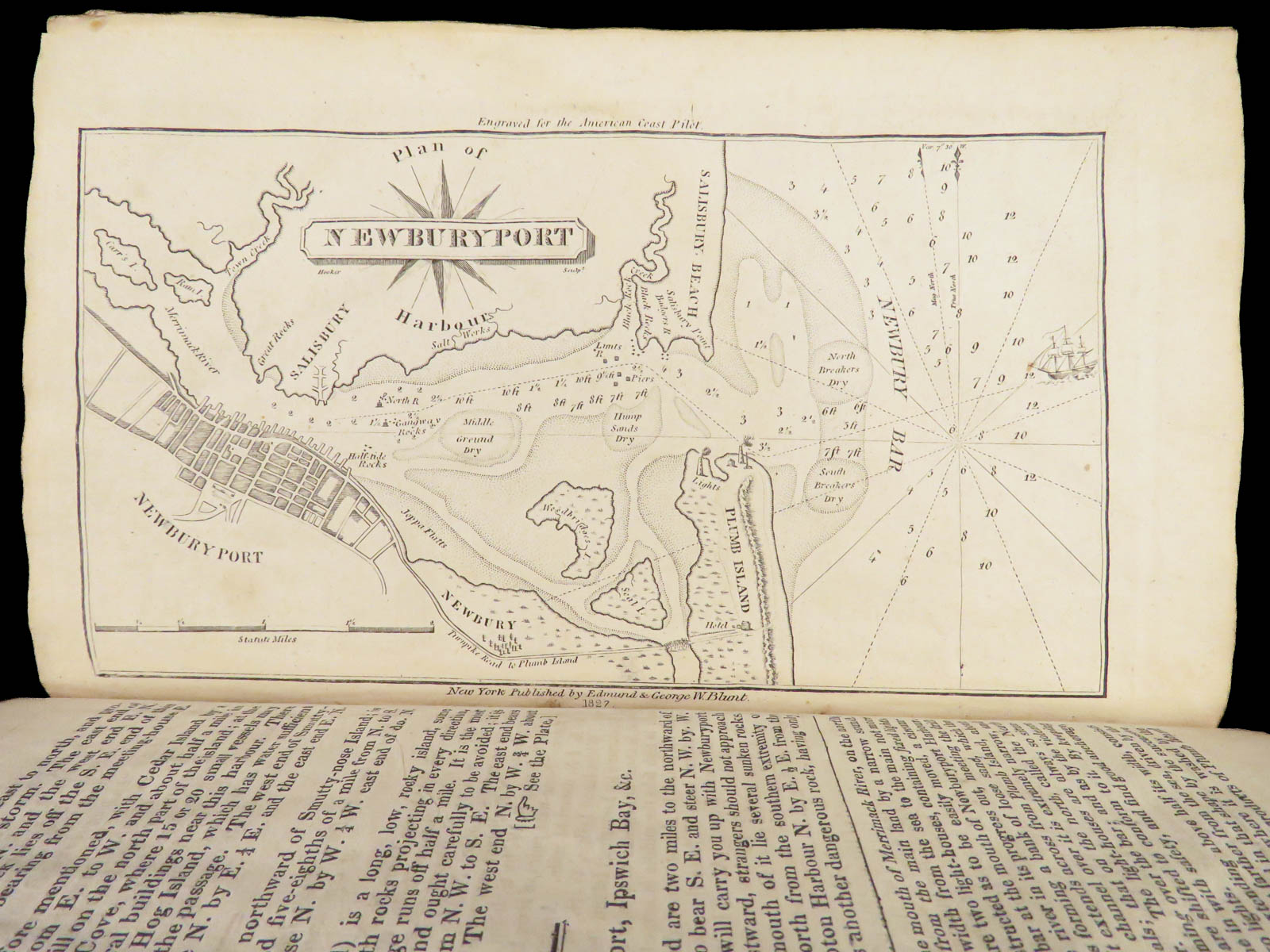
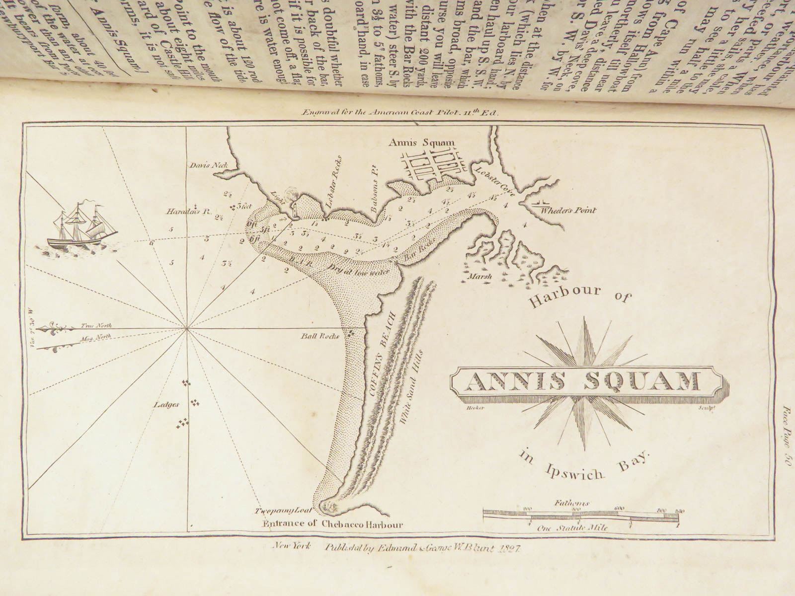
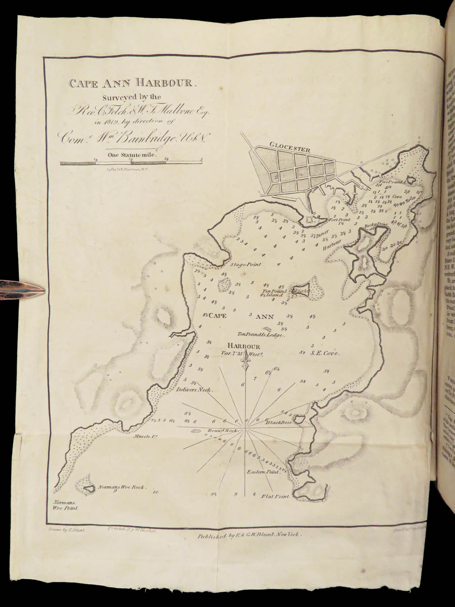
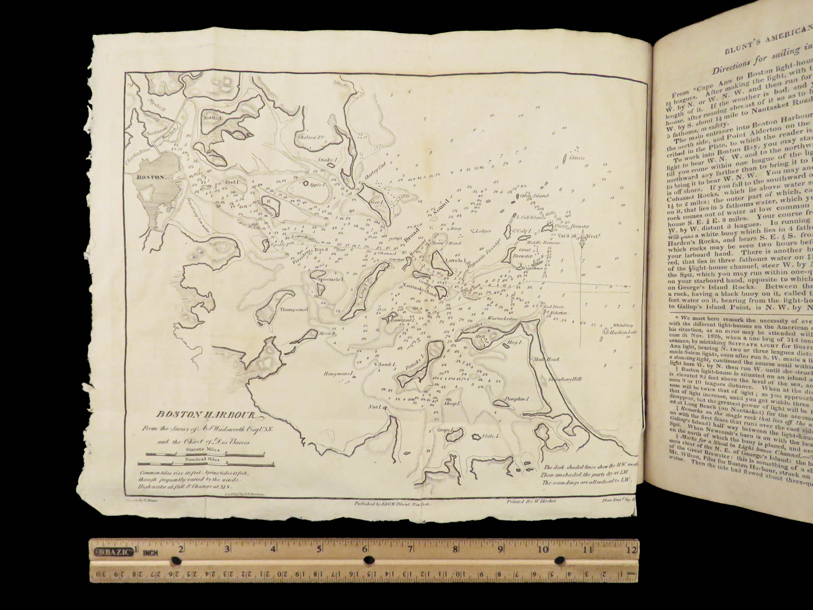
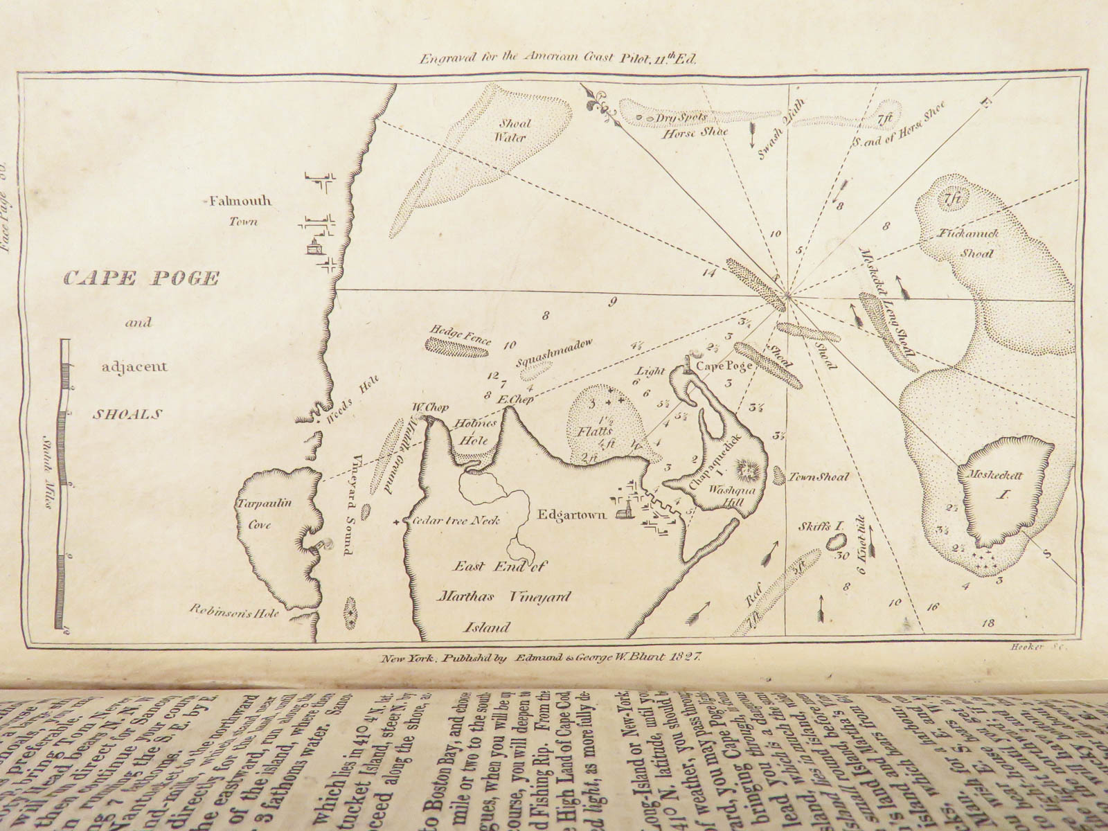
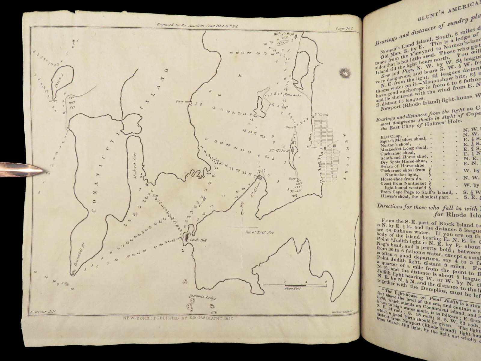
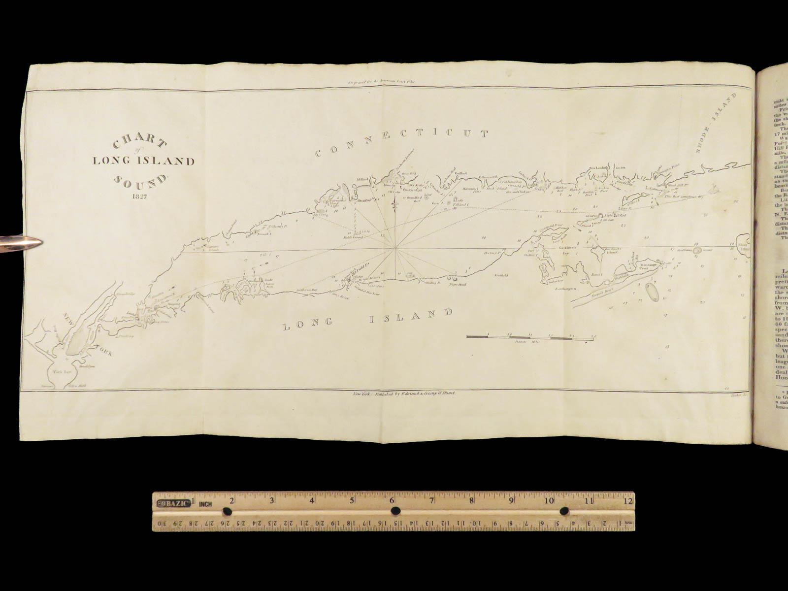
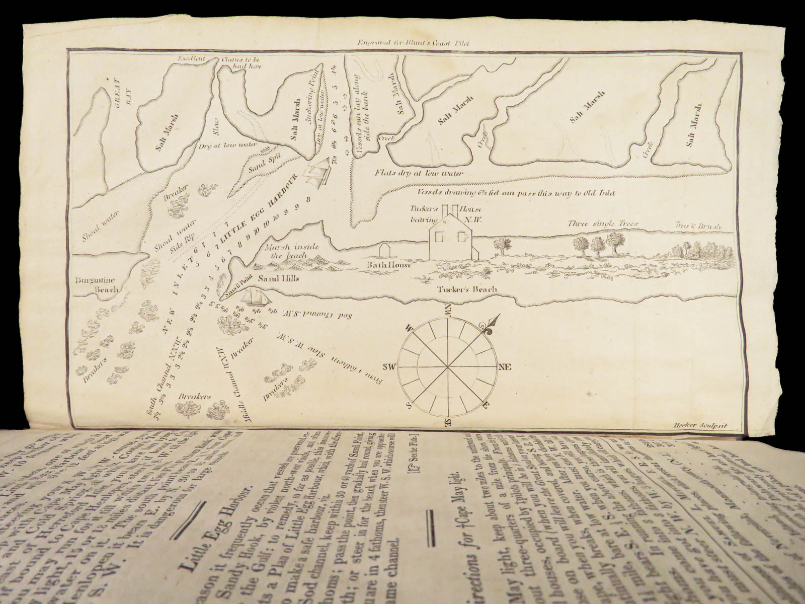
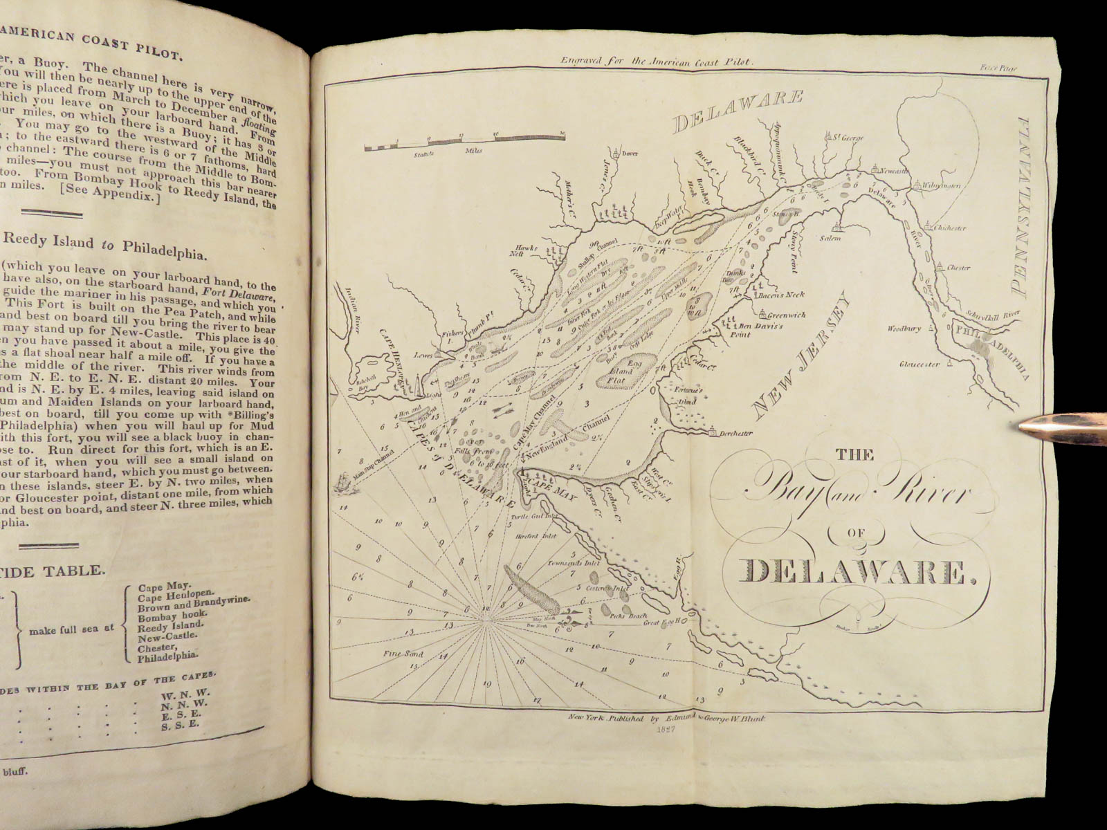
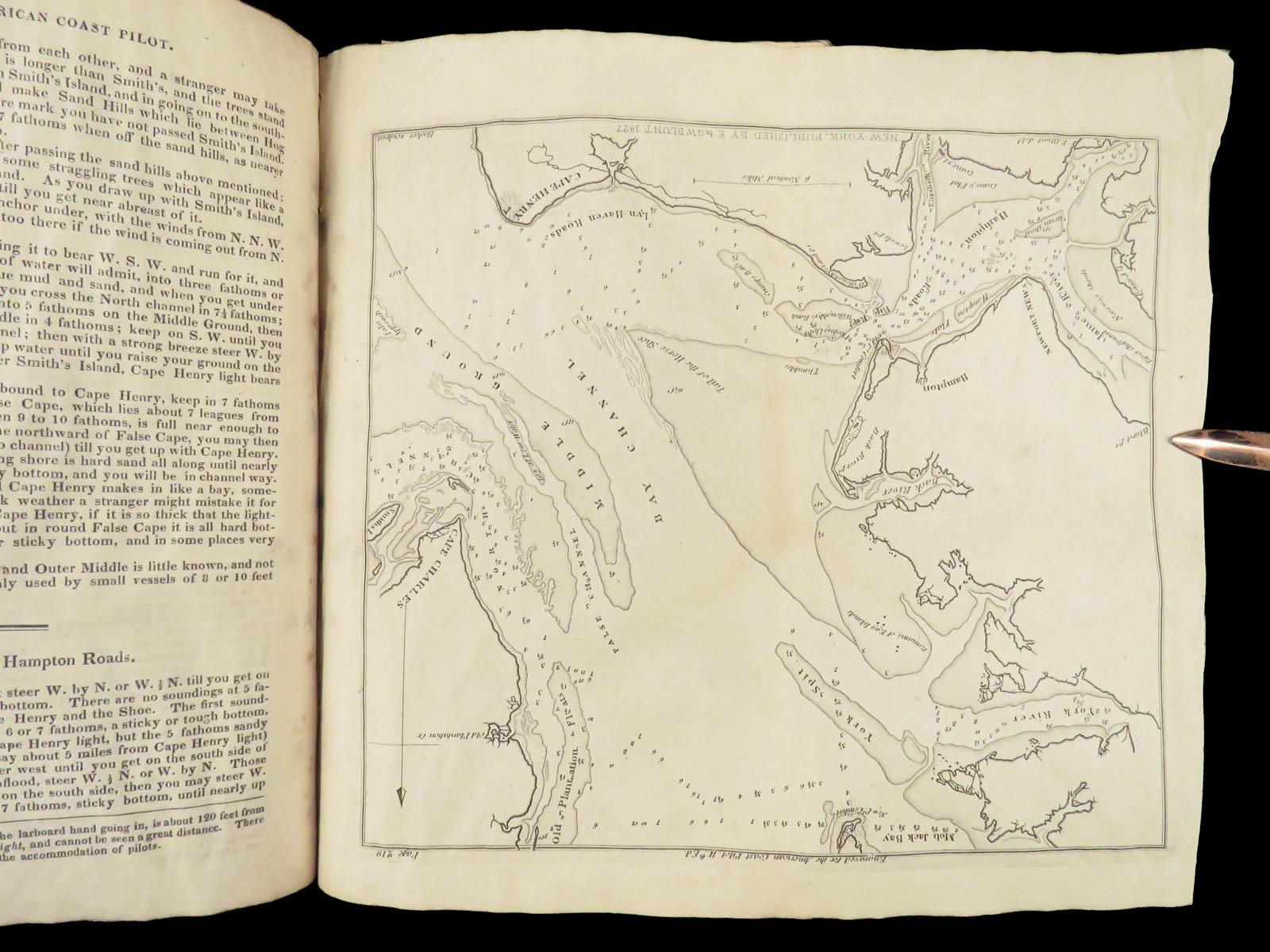
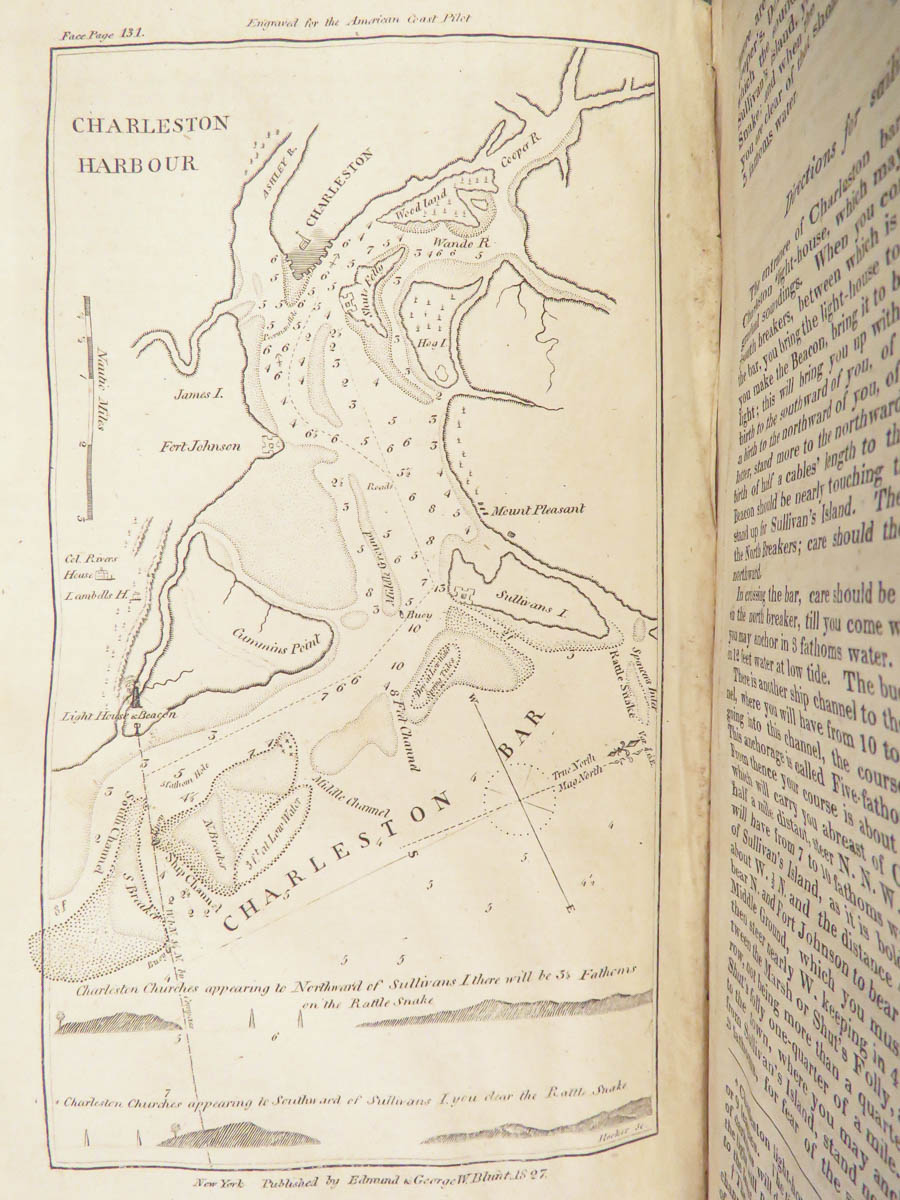
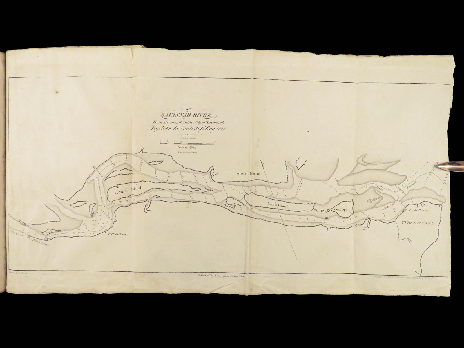
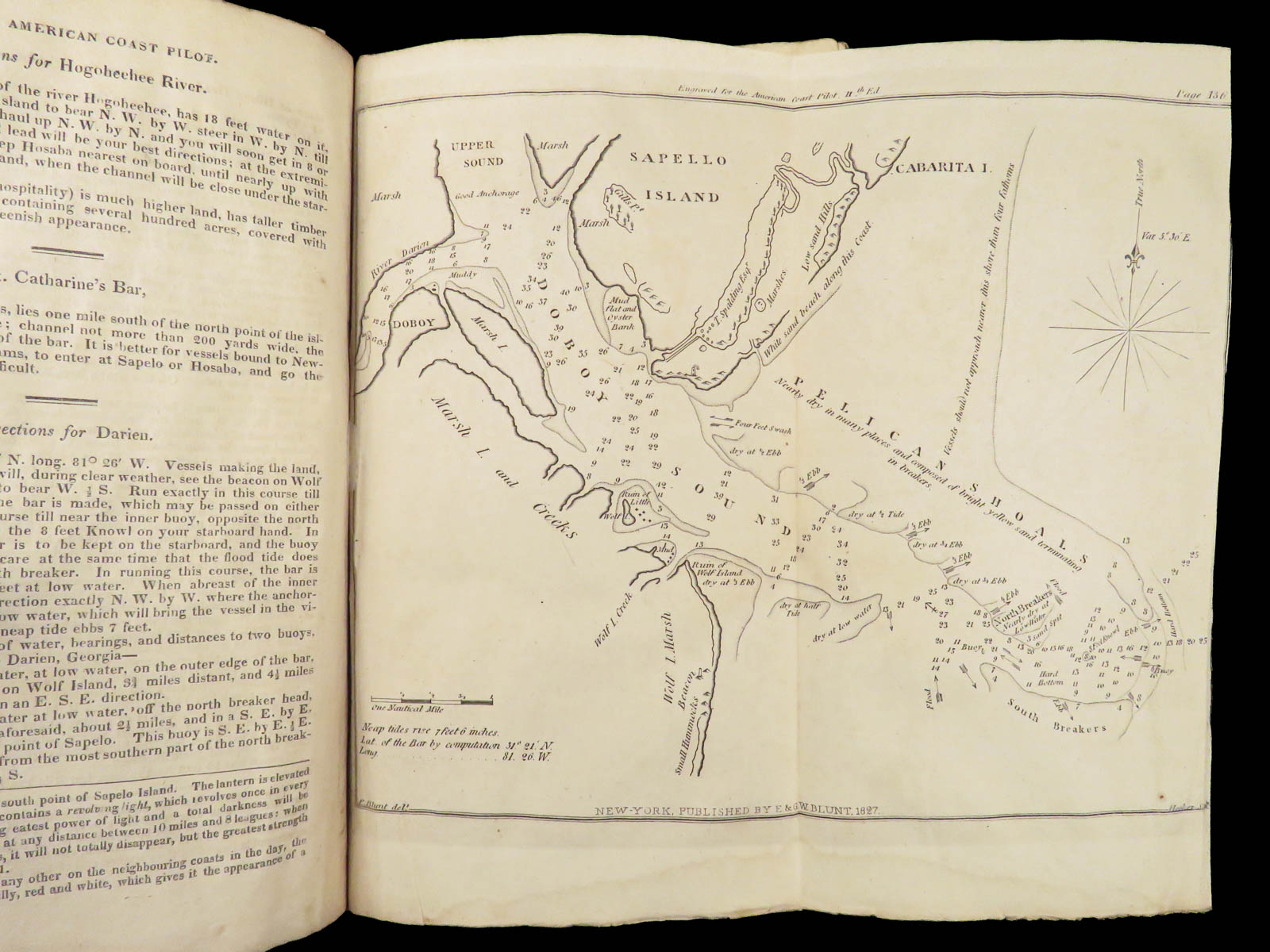
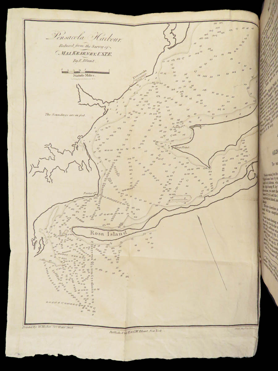
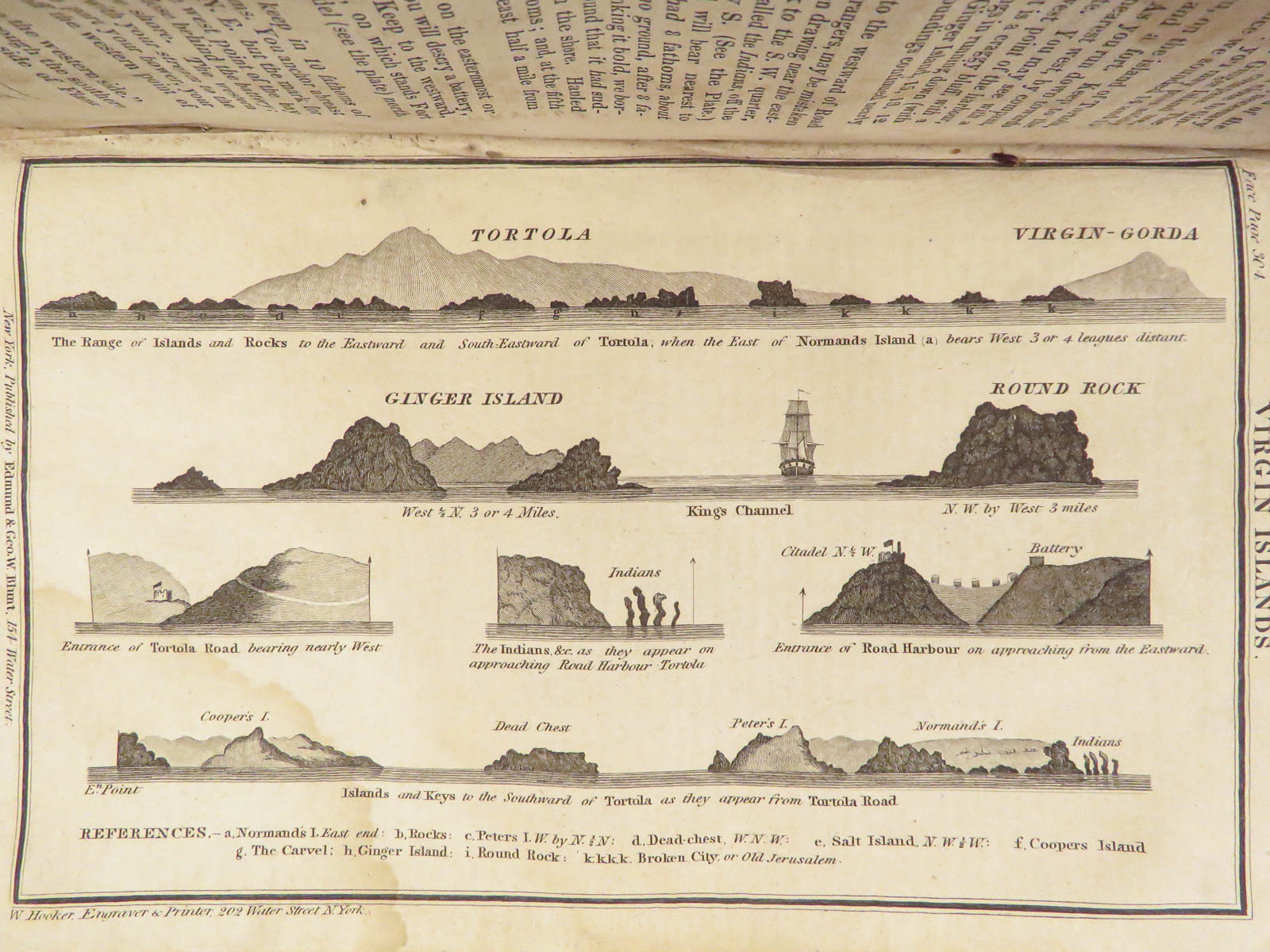
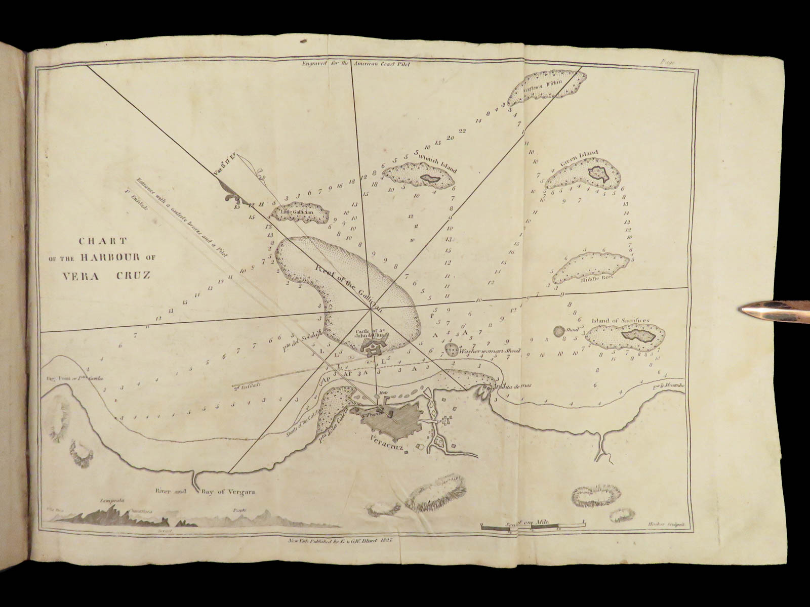
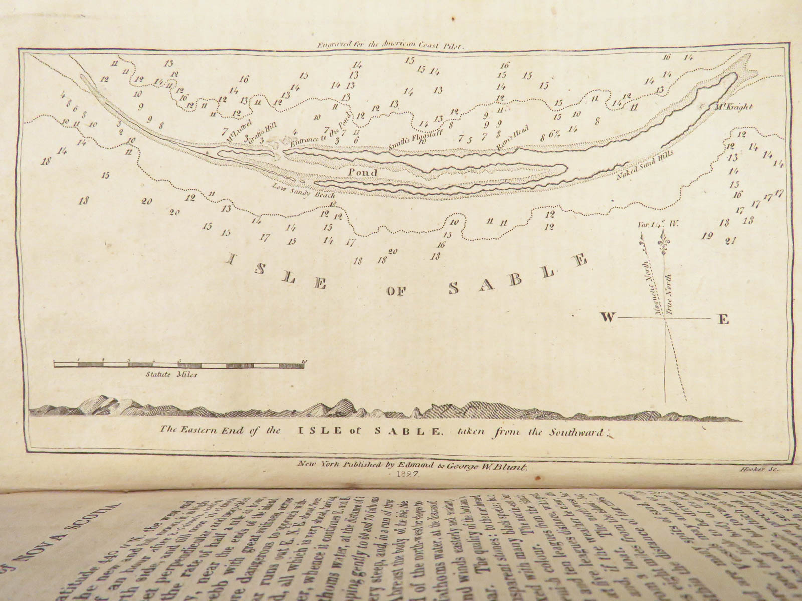
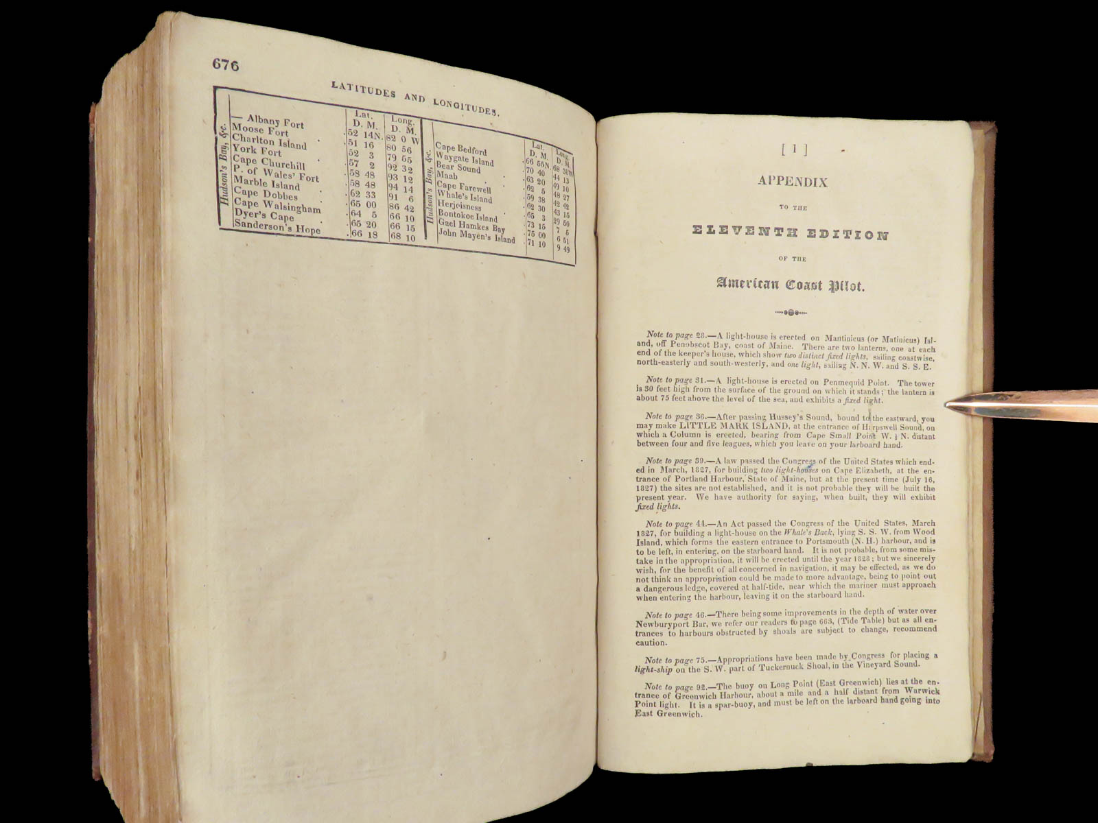
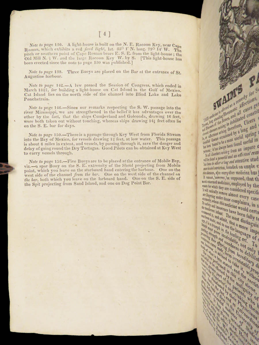
This guide was extremely important to North American voyages, and shows views of harbors as they existed prior to the Civil War. Views of Charleston, Long Island, Virgin Islands, Pensacola, and others. In includes bearings for lighthouses along the Eastern coastline, and warned against rocks, shoals, and dangerous ledges. It also charts sea currents, tides, and locations for them. This work would see twenty-one editions through 1867, before being taken over by the US Government.
Item number: #27428
Price: $599
1827 American Coast Pilot by Blunt MAPS Nautical Guide Navigation Lighthouses Harbors
Originally printed in 1796, Edmund Blunt’s ‘American Coast Pilot’ was one of the earliest American works of navigation and travel. Blunt authored other nautical works which held great esteem and merit, and, according to Allibone,
“this work sustains a high reputation for accuracy, and is in general use by American merchant-marine. It has been translated into most of the languages of Europe.”
This guide was extremely important to North American voyages, and shows views of harbors as they existed prior to the Civil War. Views of Charleston, Long Island, Virgin Islands, Pensacola, and others. In includes bearings for lighthouses along the Eastern coastline, and warned against rocks, shoals, and dangerous ledges. It also charts sea currents, tides, and locations for them. This work would see twenty-one editions through 1867, before being taken over by the US Government.
Item number: #27428
Price: $599
BLUNT, Edmund
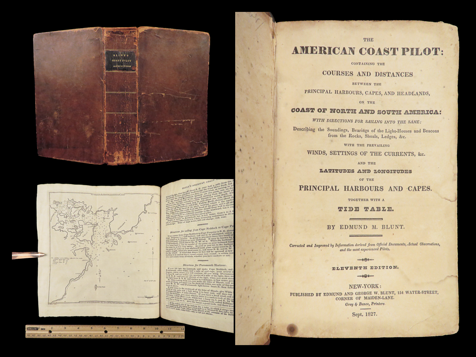
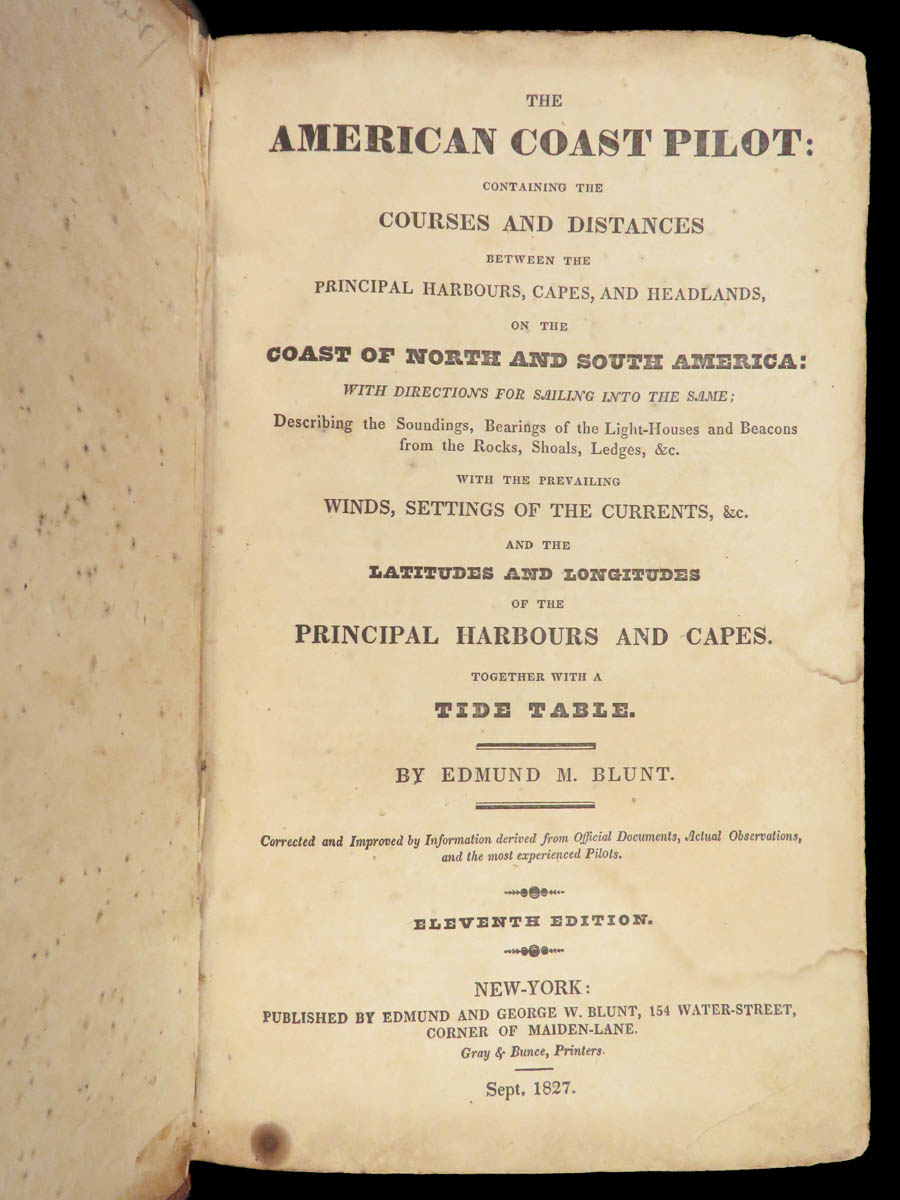
The American coast pilot : containing the courses and distances between the principal harbours, capes, and headlands, on the coast of North and South America:
New-York : Edmund and George W. Blunt, [New-York] : Gray & Bunce, Printers, Sept. 1827.
Details:
- Collation: Complete with all pages
- xvi, 676 (i.e., 682), 4, [16]
- 20 full-page and folding maps and engravings
- Several in-text woodcuts
- References: Sabin 6025; Allibone I, 211
- Language: English
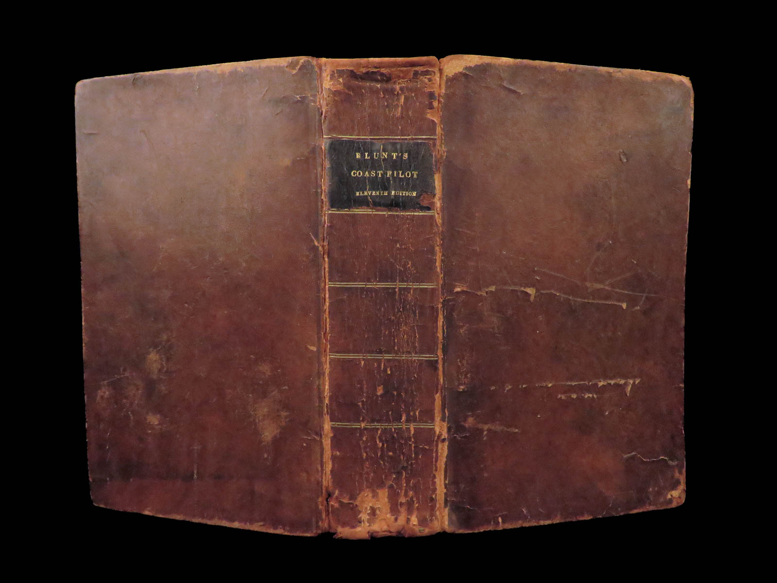
- Binding: Leather; tight and secure
- Size: ~9in X 5.5in (22.5cm x 14cm)
Our Guarantee:
Very Fast. Very Safe. Free Shipping Worldwide.
Customer satisfaction is our priority! Notify us with 7 days of receiving, and we will offer a full refund without reservation!
Categories
Americana, American History
Voyages & Exploration & Maps
Authors
BLUNT, Edmund
Printing Date
19th Century
Language
English
Binding
Leather
Book Condition
Excellent
Collation
Complete
Other Books you might like...
-
Sale!
 Add to cart
1853 1st ed Missouri Underground Railroad Military Prison Life SLAVERY Abolition
Original price was: $499.00.$399.00Current price is: $399.00. -
Sale!
 Add to cart
1882 1st ed Life of Ambrose Burnside Union Army General CIVIL WAR Rhode Island
Original price was: $499.00.$450.00Current price is: $450.00. -
Sale!
 Add to cart
1866 1ed New York Stage American THEATER Actor Joseph Ireland James Hackett 2v
Original price was: $550.00.$450.00Current price is: $450.00. -
Sale!
 Add to cart
1867 American NAVY1st ed Officers Illustrated Farragut Civil War Ironsides Ship
Original price was: $499.00.$399.00Current price is: $399.00.