1874 Chisholm’s Route NEW YORK & Canada St. Lawrence Niagara Illustrated MAPS
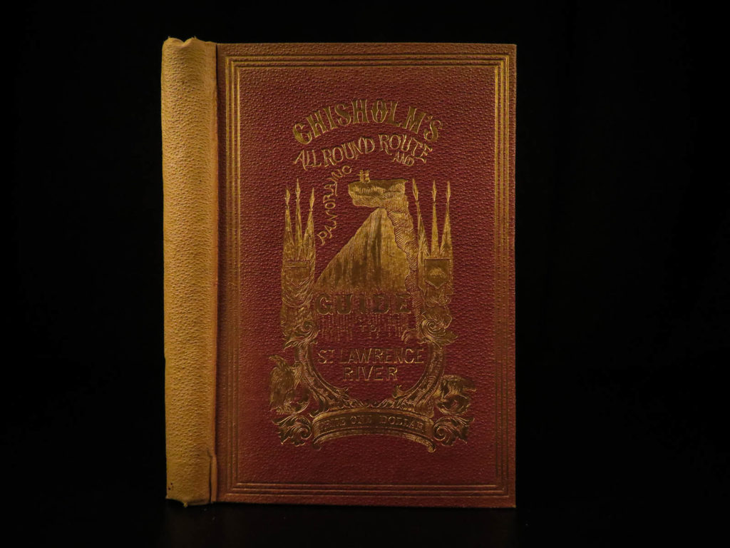
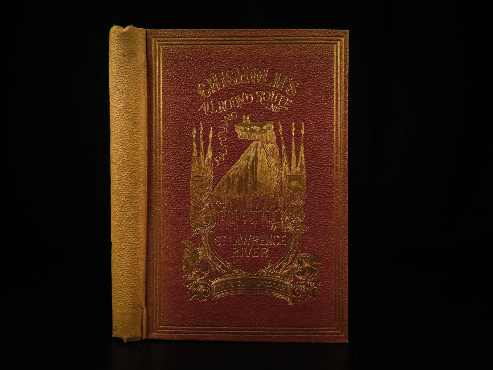
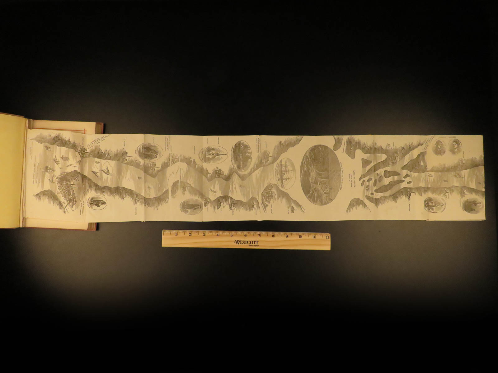
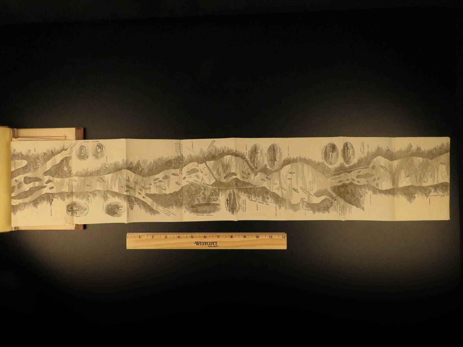
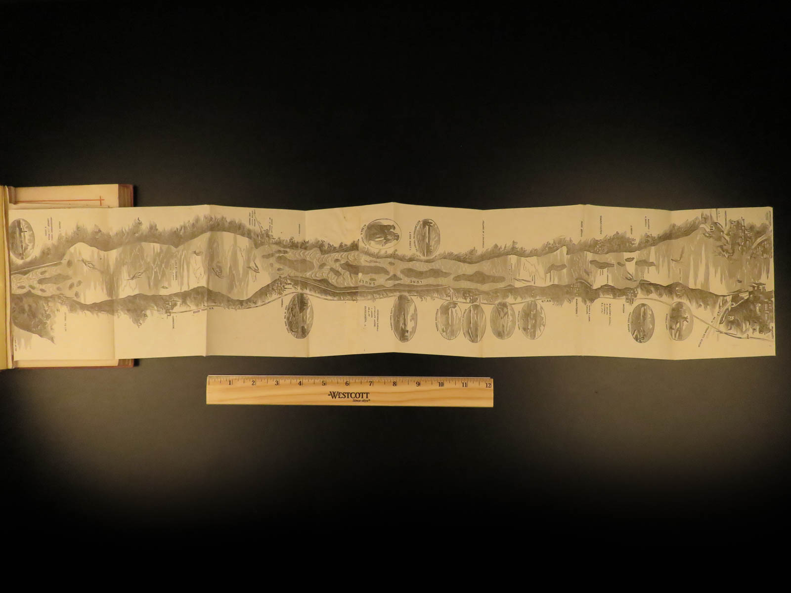
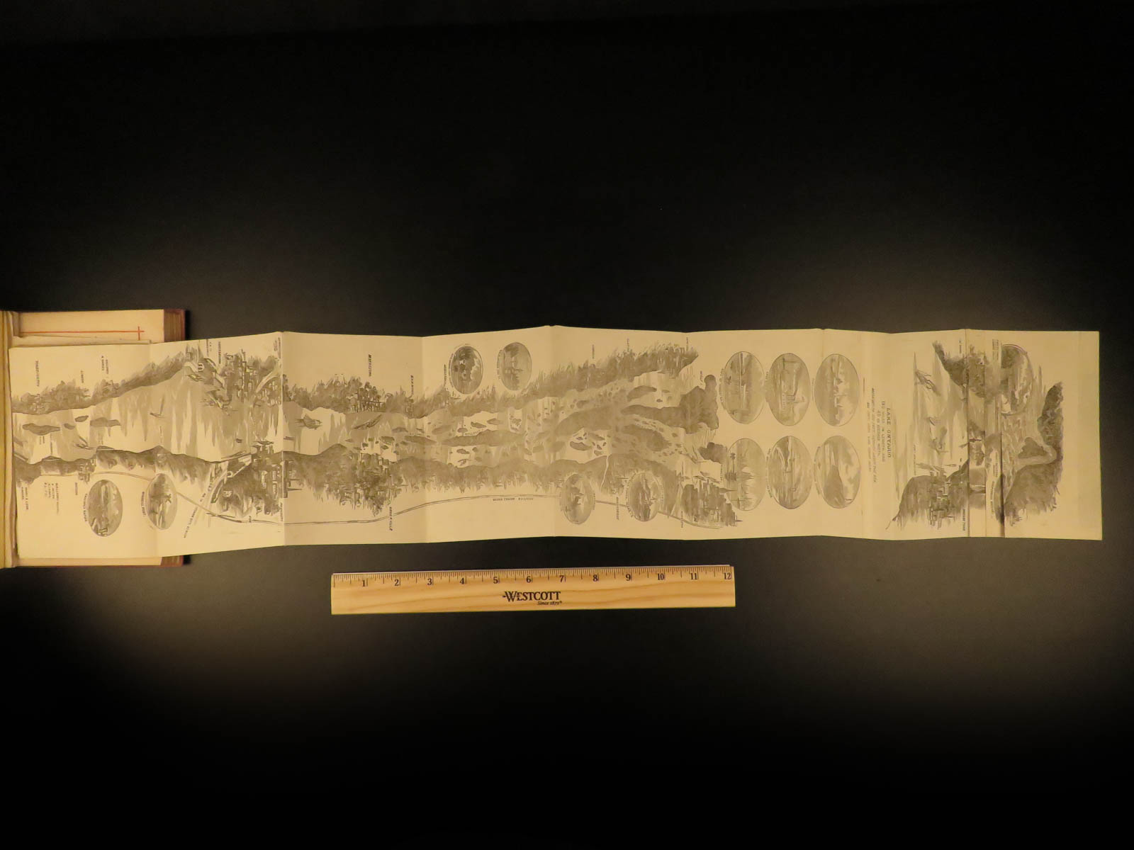
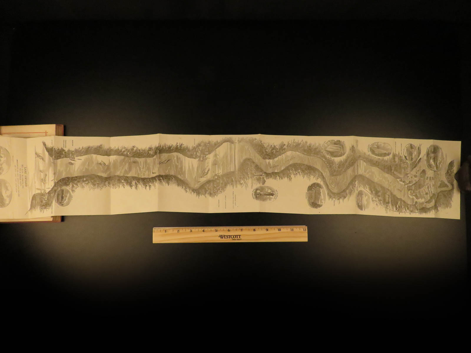
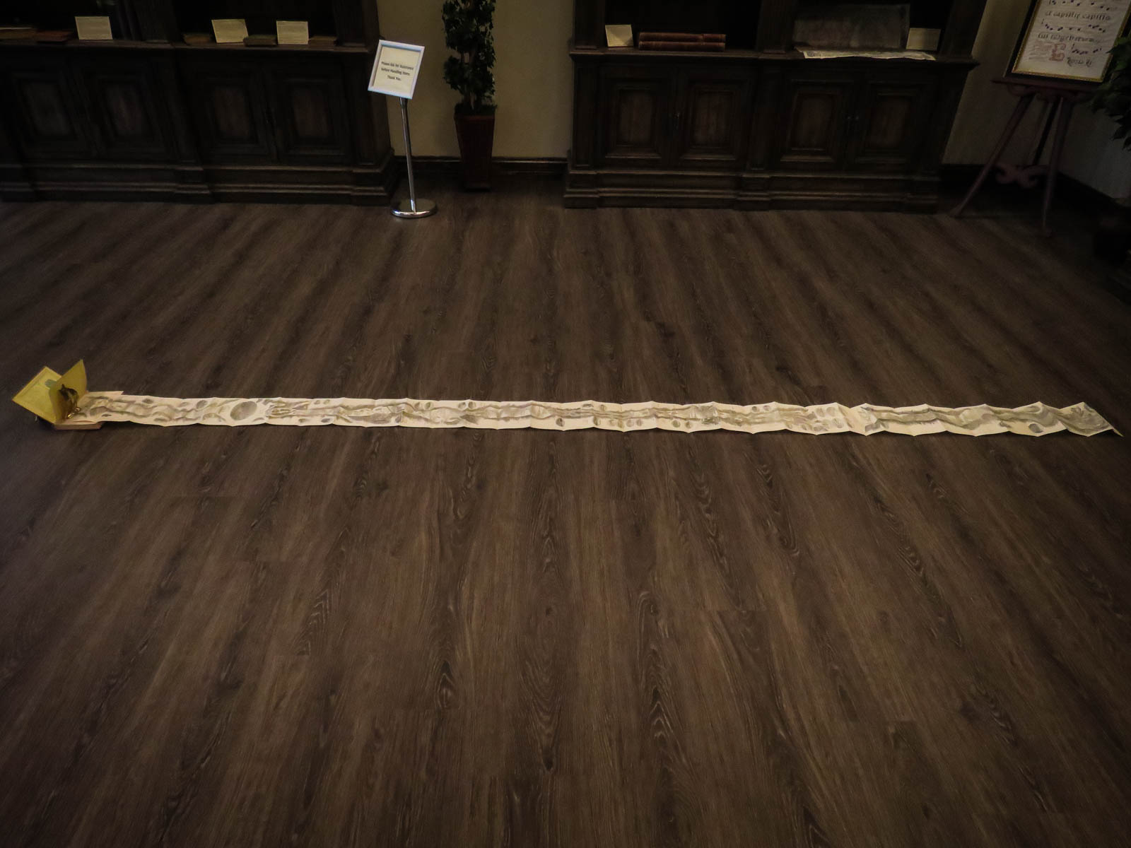
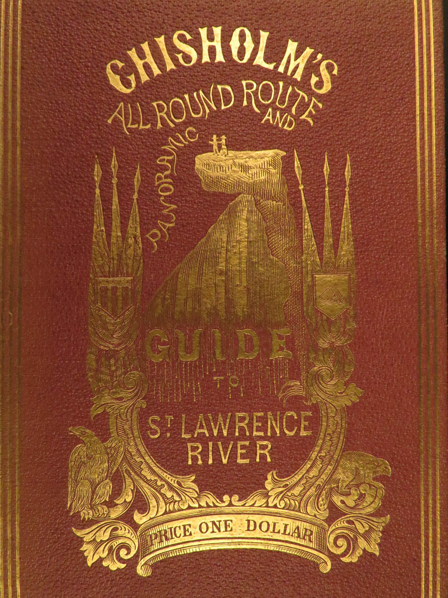
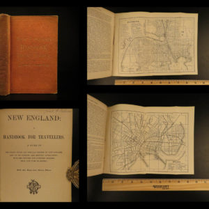
‘Chisholm’s all round route and panoramic guide of the St. Lawrence’ is a railroad excursion guide for vacationers from 1874 when steam boats and railroads were making vacation and travel an option for the rising middle class. This book gives a screen shot of the past with its illustrations and large fold out maps. The frontispiece is a folding panorama by Alfred E. Waud. It is a full 11 1/2 feet long with 40 engraved panels showing both sides of the river from Quebec to Cape Vincent, with an add on of the Niagara River & Falls. This book illustrates places including:
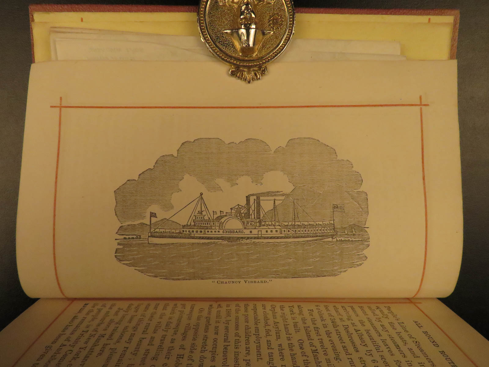
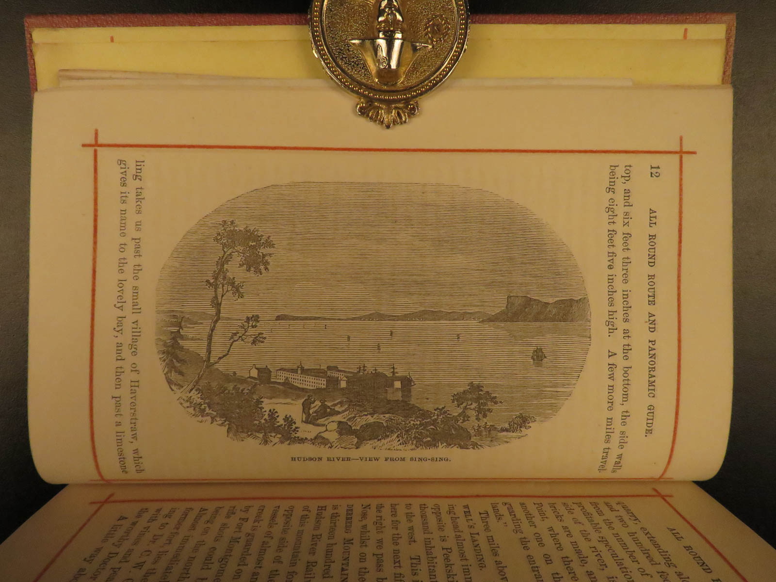
- The Hudson River
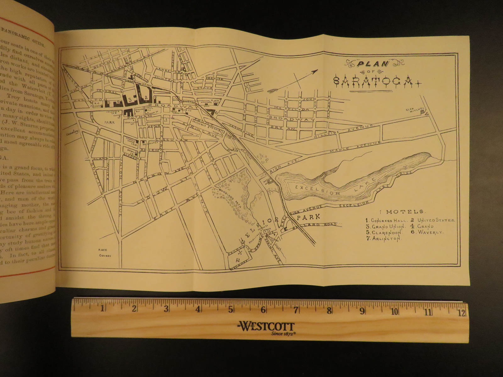
- Saratoga
- Trenton Falls
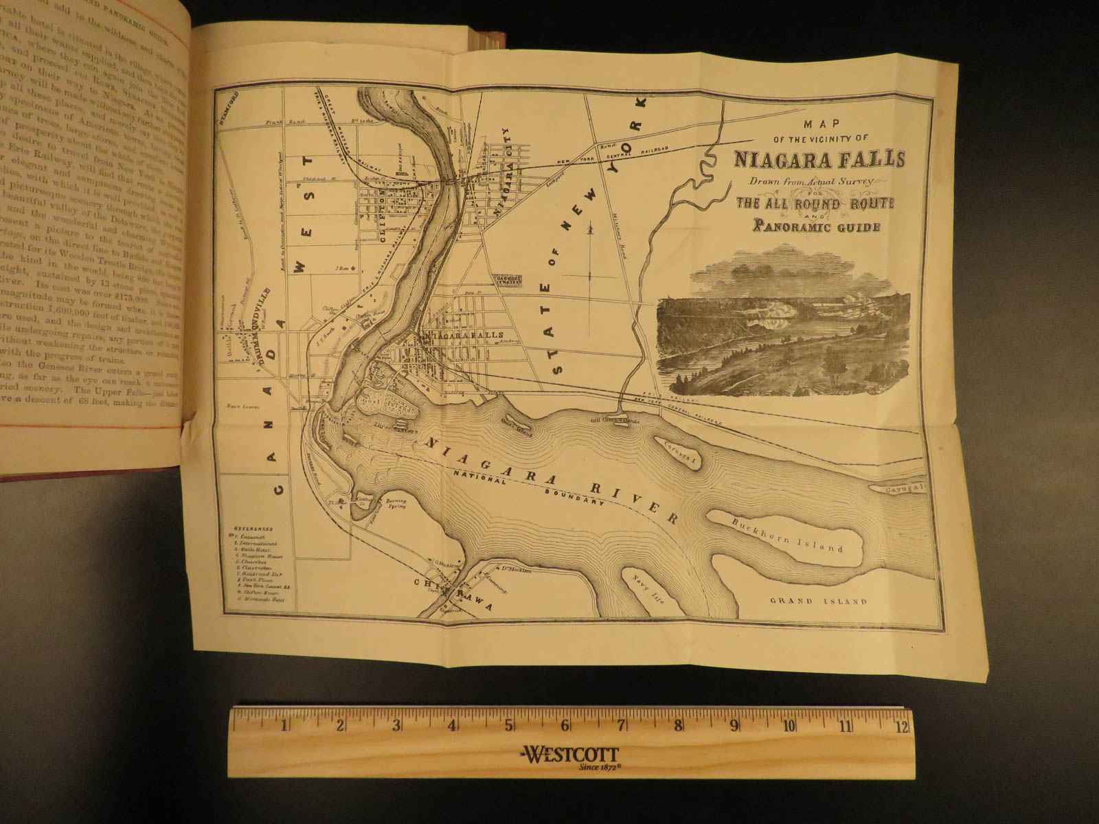
- Niagara
- Toronto
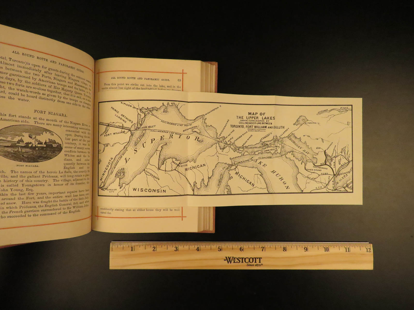
- Thousand Island
- Montreal
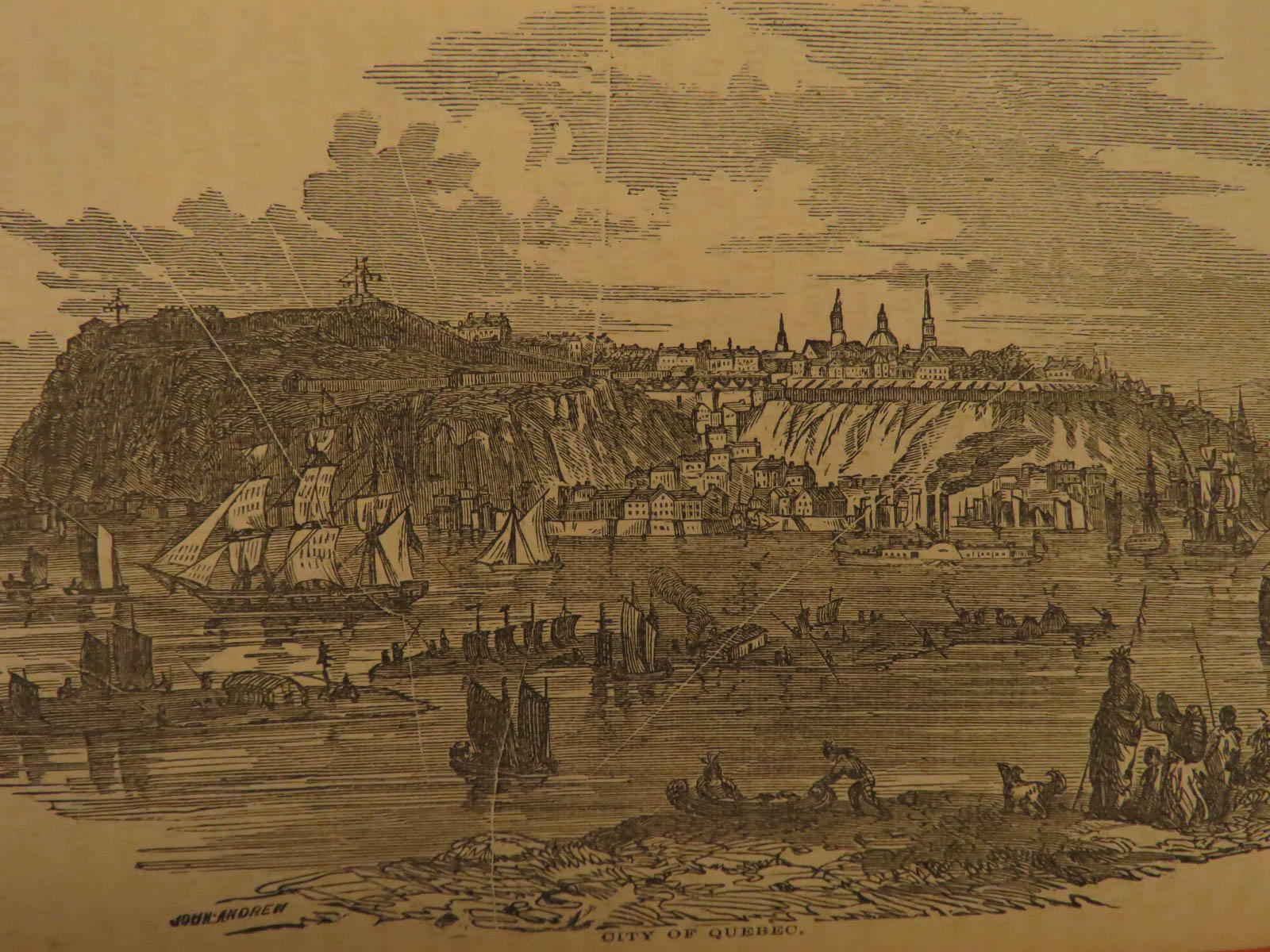
- Quebec
- The White Mountains
- Portland
- Boston
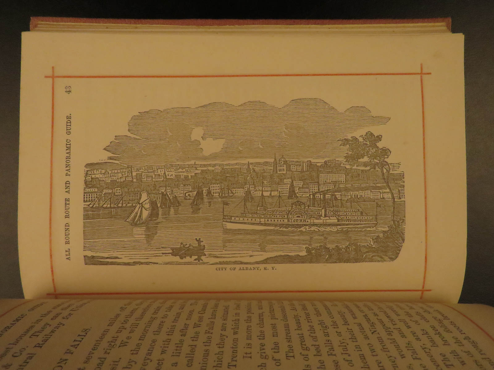
- New York
- And more!
This 1874 edition is bound in decorative cloth with gold embossing and includes 6-fold-out maps. Of note, the massive frontispiece is a folding map that measures in over 11.5 feet long!


1874 Chisholm’s Route NEW YORK & Canada St. Lawrence Niagara Illustrated MAPS
‘Chisholm’s all round route and panoramic guide of the St. Lawrence’ is a railroad excursion guide for vacationers from 1874 when steam boats and railroads were making vacation and travel an option for the rising middle class. This book gives a screen shot of the past with its illustrations and large fold out maps. The frontispiece is a folding panorama by Alfred E. Waud. It is a full 11 1/2 feet long with 40 engraved panels showing both sides of the river from Quebec to Cape Vincent, with an add on of the Niagara River & Falls. This book illustrates places including:
- The Hudson River
- Saratoga
- Trenton Falls
- Niagara
- Toronto
- Thousand Island
- Montreal
- Quebec
- The White Mountains
- Portland
- Boston
- New York
- And more!
This 1874 edition is bound in decorative cloth with gold embossing and includes 6-fold-out maps. Of note, the massive frontispiece is a folding map that measures in over 11.5 feet long!
Item number: #8665
Price: $750
BARHAM, Richard Harris.
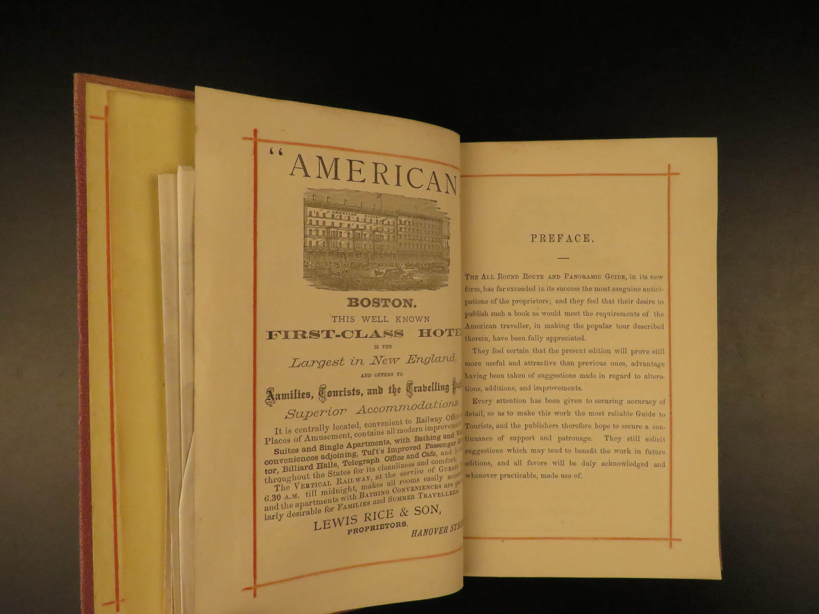
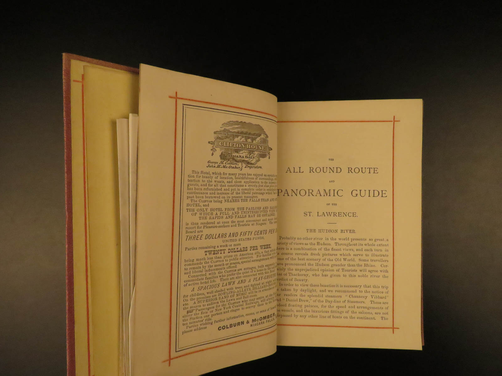
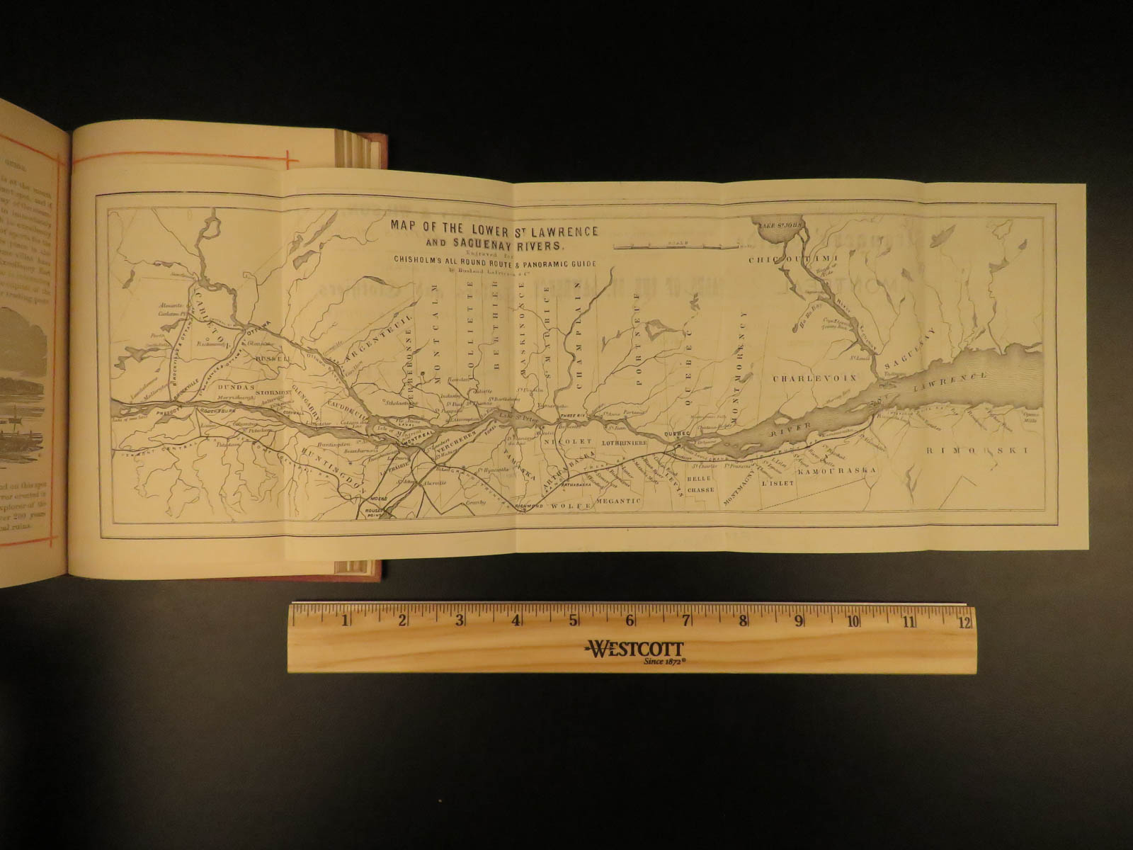
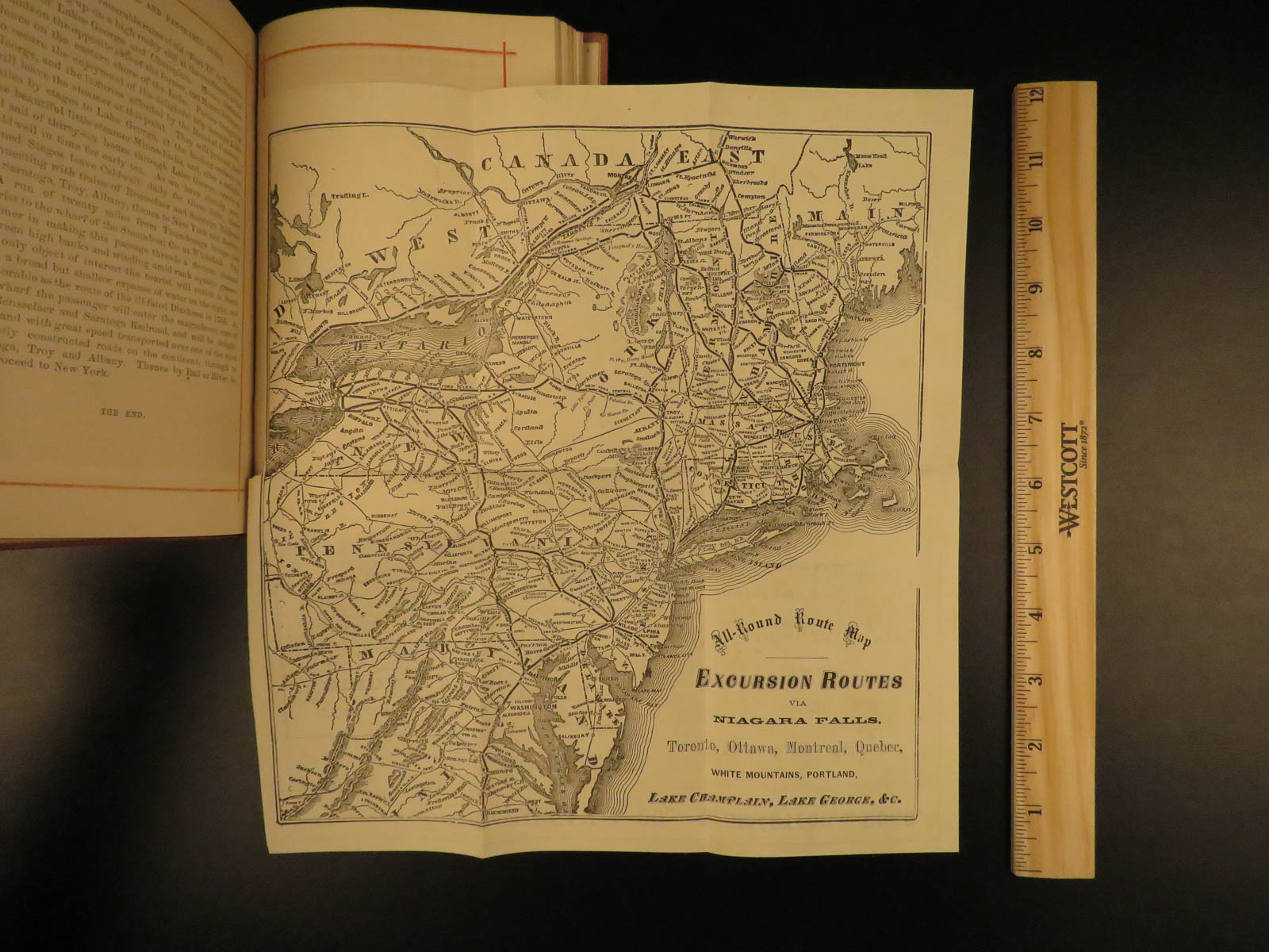
Chisholm’s all round route and panoramic guide of the St. Lawrence: the Hudson River; Saratoga; Trenton Falls; Niagara; Toronto; Thousand Island, and the river St. Lawrence; Ottawa; Montreal; Quebec; the lower St. Lawrence and the Saguenay rivers; the White Mountains; Portland; Boston; New York.
Montreal: C.R. Chisholm & Bros., 1874. 1st edition
Details:
- Collation: Complete with all pages
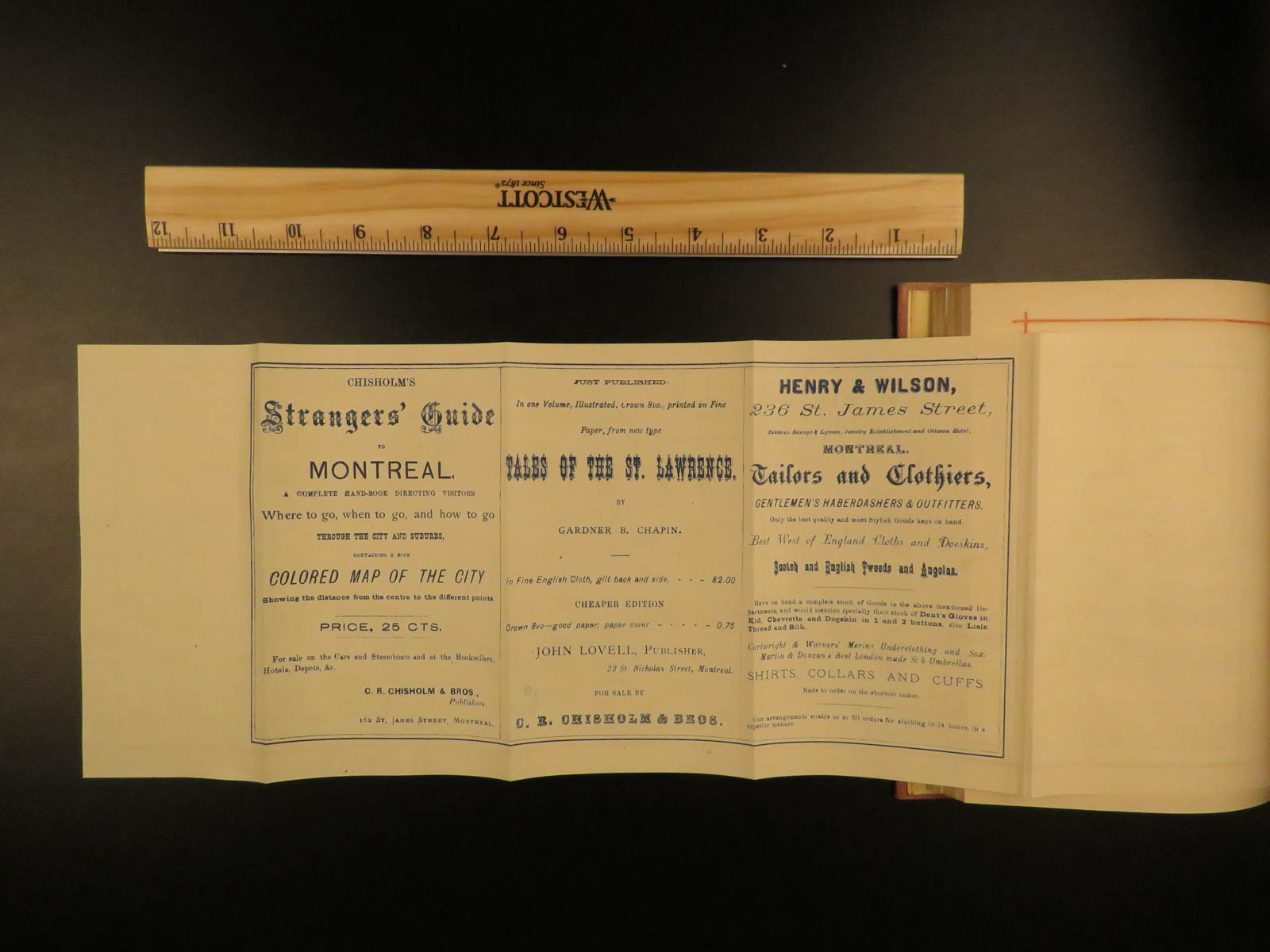
- 176, [66 ads]
- 6 folding maps
- Language: English
- Binding: Hardcover; tight & secure
- Size: ~8in X 5.5in (20cm x 14cm)
- Extremely rare & desirable with no other example for sale worldwide
Our Guarantee:
Very Fast. Very Safe. Free Shipping Worldwide.
Customer satisfaction is our priority! Notify us with 7 days of receiving, and we will offer a full refund without reservation!
8665
Categories
Americana, American History
Voyages & Exploration & Maps
Authors
BARHAM, Richard Harris
Printing Date
19th Century
Language
English
Binding
Hardcover
Book Condition
Excellent
Collation
Complete
Other Books you might like...
-
Sale!
 Add to cart
1873 1ed Osgood New England ATLAS Traveler Guide MAPS New York Quebec Geography
Original price was: $499.00.$399.00Current price is: $399.00. -
Sale!
 Add to cart
1794 EARLY American Biography Belknap Columbus Soto Cortez Magellan Puritans 2v
Original price was: $950.00.$850.00Current price is: $850.00. -
Sale!
 Add to cart
1807 1ed Peace Without Dishonor anti Revolutionary WAR Argument Propaganda Ships
Original price was: $499.00.$399.00Current price is: $399.00. -
Sale!
 Add to cart
1843 True 1st INDIAN Tribes Lang & Taylor Report on Cherokee Native Americans
Original price was: $550.00.$450.00Current price is: $450.00.